Tuesday, December 13, 2016

Incredibly Rare Snowspout! Lake Effect Snow Event 12/8/2016

Record warm Lake Erie waters and an arctic plunge from Canada were setting the stage for a classic Lake Effect snow event for Ohio, Pennsylvania, and particularly New York. With how epic the Buffalo blizzard of 2014 was i'm pretty hesitant to chase Lake Effect anymore. After all. How could that be topped? But, with talks of 2-3 feet of snow and a week off of work due to hours cut the thought was in the back of mind to go for it. December 7th rolled around and my friend Thomas had messaged me informing me that he was on his way from Canada to document this event and had invited me to come along when I arrived up there. Earlier in the day I was pretty committed on not going. Although it would have been nice to see friends, I just couldn't find the motivation to fund a trip to New York after just returning from Alberta and the Northwest Territories of Canada. But, as if the weather Gods were speaking to me, I received not one, but two gas gift cards in the mail for Christmas that day. The decision had been made and I was on my way to New York to meet up with Thomas and cover this event.


Snow isn't a particularly appealing weather choice for most chasers. But, some of the most intense chases I have been on have indeed been blizzards. Now, I won't drive to North Dakota for a Winter Storm Warning. But, these power house blizzards that can sweep in can really make for incredible scenes on a chase. With major cities being crippled and brought to their knees is pretty impressive for weather to do. Let alone in the form of snow. At least in my opinion.

I arrived in my target of Dunkirk, New York around 1130pm and met up with Thomas and Reed at Applebee's to grab a couple drinks before heading to the hotel in preparation for what tomorrow had to unfold.


I was super exhausted from working all day then driving 4 hours to Dunkirk, so I was out pretty early. The next morning snow had already began to fall and before roads became bad we adjusted to Maysville, New York. A location in which was higher in elevation and a location where we felt would received higher snowfall totals judging by where the LES band was setting up. By noon, the snow was in full force with whiteout conditions and roads quickly becoming snow covered with cars and semis sliding off into the ditch and struggling up the hilly terrain of Northeast, New York.


Pictured above is Reed in his rental as at times it became hard to see him due to the poor conditions outside as we near I-90 approaching a heavier snow band. After driving back up to Dunkirk and filming a bit around town, we jumped back on 90 (for probably the 10th time in 2 hours) and pulled off at an Exit ramp as Reed's 360 degree camera died and needed charged for a few minutes. Little did we know how key this 10-15 minutes would be. 


The chase resumes. We decide to head back towards our hotel as another heavier snowband was setting up. As we drove Westbound on 90 clearing a lake effect band, nearing the town of Westfield we noticed something odd behind the tree line. We poked through a clearing and what we swore looked like a funnel cloud appeared. There's no way. Its actively snowing right now. Surely our eyes are playing tricks on us? That's got to be scud of some sort. Thomas and I both said "I wonder if Reed is seeing this?" and as soon as we said that Reed floored it ahead to clear the trees. That answered our question, and we did the same. 


It had that shape. Still. There is absolutely no way this is what I think it actually is. Right? As it continues to further organize and come closer and closer to the ground. It emerges from the tree line and there was no denying it now. I can see it spinning. Not just spinning, but strengthening and damn near fully condensed. A freaking waterspout was underway!!! Never in my life did I ever imagine i'd see a waterspout while it was snowing!


This spout was now going for almost 2 minutes as it continues to push off to my East. I'm still in disbelief. Surely I am dreaming right now? 2 minutes 30 seconds later it finally begins to rope out (note the snow actively falling in the shot)


After roping out Reed ran up to our car and we all high five each other in celebration. We just witnessed something probably not a single other storm chasers has ever witnessed. All by dumb luck too. Had we not stopped for that short time to let his camera charge this would have been yet another snowspout gone undocumented. Even knowing what I saw, and knowing what it was. I was incredibly nervous about posting this to social media. Seeming how people are how they are and would likely accuse me of lying. When, in fact. The opposite happen. The photo went viral on both Twitter and Facebook getting many RT's and shares from people in disbelief.


I literally laughed out loud as 80% of the comments were "I HATE YOU AARON!!!" in a friendly way of course and the group chat that I'm in was a continuous thread of HOW LUCK CAN SOMEONE GET I LOVE AND HATE YOU!!! I was also informed that until I captured this image there were only 6 known photos of these occurring and no video. So not only did I capture the 7th image ever, I also captured the very first video of one. Quickly making its rounds on National News headlines. I was on cloud 9 and honestly didn't even care about the snow at that point. 

My chase partners Alec and Stephen couldn't have been happier for us and Alec even made the joke about my luck this year stating that "Only Aaron can chase snow and see a freaking tornado, just like only Aaron can hike 1,000 miles, come back for two days, and see the best tornado of 2016". Not being able to stay in New York for the full duration of this event due to prior commitments at home made this even more satisfying. This just goes to show, once you think you've seen it all. Mother Nature throws something new that you've never seen before at you in the least likely of scenarios. Night fell and Reed, Thomas and myself celebrated with steak and beer and were joined with Mike Siedel and crew from The Weather Channel. Them too in disbelief at what we witnessed earlier as the footage ran on the TV's as we sat in the bar. We ended up with a foot of snow before the band let up just long enough for me to begin my trek home. Which ended up taking forever due to multiple massive pile ups near Erie and Cleveland. There was also a persistent LES band hammering Northeast Cleveland making the highways almost impassible as I slowly crawled my way home into the early morning hours. At one point cars were sliding back down the hill the highway went up due to lack of traction. I had my foot floored and was barely making it up, cruising at 10mph. 

Arriving home, I still tried to gather my thoughts as to what happened. Still didn't seem real. What a chase day! 

Footage 


Thursday, October 20, 2016

Major Hurricane Matthew Intercept-10/6/2016


With the results of my last hurricane chase (Hermine) still fresh in my mind, and going through the stress of getting approved for a loan, down payment, and finding a new car to chase in for over a month now. Another hurricane was taking aim at the US. However, this would be a much bigger beast to tame. It didn't take long for now Matthew to become a Tropical Storm and rapidly intensify into a category 1 hurricane as it tracked into the Caribbean. Initial long range models had Matthew becoming a classic "Caribbean Cruiser" as chasers call them. Taking it South of Cuba and curving up into the Gulf of Mexico turning it into a Major Hurricane (Cat 3 or higher). However, as models got a better handle on Matthew, that solution came to an abrupt hault as models were now picking up on Matthew getting picked up by the first trough, taking it on a due Northerly course into Cuba, Haiti, and the Bahamas and curving back out to sea as another trough ejected from The Great Plains. I had mixed emotions about this. On one hand, I didn't have to stress about missing the potentially first Major Hurricane landfall in a decade because of a car. But, at the same time my inner chaser nerd was clawing at my insides with slight anger that another hurricane would turn out to sea.


Not so fast though! As the event progressed and Matthew now a Category 5 Hurricane (yes you read that correctly) South of Cuba after undergoing a 20mlb pressure drop in less than 48 hours models were now showing something ominous. With each run the trend continued to shift West. Closer, and closer to the East coast. North and South Carolina in particular. Models still weren't showing a landfall before Matthew drifted back out to sea. But we were now within 50 miles of the OBX (Outerbanks) of North Carolina. At this point, I have to look into gambling and heading down to the coast. Even if a Major Hurricane were to stay 50 or so miles off of the coast. The affects would still be destructive. Especially with storm surge. Now, my main problem at this point was the hurricane was projected to near the coast or make landfall a day or two after I had to give my rental truck back. Something I had been driving since my backup car also broke. Yea, its been one of those kinda months. My initial plan was to get a rental car even though I didn't exactly have the extra funds to do so and head down with my chaser partner Alec Scholten (Twisted Sky Tours) and we'd meet up with my other chaser partner Stephen Jones. Nerves were particular higher with Stephen, and for good reason as he has lots of family in South Carolina and some models were showing the exact track of previous Hurricane Hugo. Which made landfall in Stephens hometown causing millions in damages.


Both the Euro, and GFS spaghetti models were now locked and loaded showing the hurricane making landfall along the East Coast in the Carolina's around the 10th-12th time frame. By chance, I walked into my Credit Union to see if I had gotten pre-approved for my loan yet for my new car and sure enough, only a day later it was. Finally, something good was coming my way. Not only was I able to get a car now, I was able to save money by not getting a rental and taking my own vehicle.

Matthew was already on a rampage. Killing hundreds in Haiti, mass damage in Cuba, and now taking aim at the Bahamas. Still as a Category 4 Hurricane. Matthew was now the longest lasting Major Hurricane in the Caribbean in over 30 years. Four days it had been a Major Hurricane now. There was however one slight problem. The Western trend refused to stop and now we were potentially looking at a Florida landfalling Hurricane. What was causing this? A stronger Bermuda High Pressure than originally forecast. A ridge had built over the Atlantic and a Negatively tilted trough (that was sparking severe weather in the great plains while the Hurricane was in the Atlantic) had slowed down. Thus, the Western shift continued. Great. Back in Florida for another Hurricane. What could possibly go wrong like the last time? It was almost as Florida was taunting me to come back for a rematch. Stephen would arrive sooner than Alec and I to scope out areas to ride out the Hurricane as I had to work the day before we left and couldn't hit the road until I picked up my car around 6pm. Which absolutely sucked that this was taking aim at Florida. This mean yet another 14 hour, no sleep drive ahead. Thankfully, I would have someone with me to keep me awake unlike my last minute split decision to chase Hermine and drive the 14 hours all night alone down there. This would also make landfall sooner. Matthew if it were to make landfall would approach Florida on the 6th. So we had to rush as mandatory evacuations were underway up and down the coast, and the biggest evacuation in the history of Florida was underway as models continued to not weaken Matthew and so many models made landfall as a cat 4+ Hurricane. Knowing what had just happened in Haiti, Cuba, and the Bahamas I had a knot in my stomach for this chase. Something I have never experienced before and I hadn't even left yet. Later that night I picked up my new chase vehicle from Richart. A 2011 Chevy HHR with only 75,000 miles on it. Same vehicle as last time, but much newer and much less miles. Literally after leaving the car dealership I made my way to Florida. Which in my eyes is hilarious. I can't think of many people who have bought a new car and then immediately after leaving the dealership go chasing. Total a car by hitting a tree in a hurricane, buying new car, then going to chase another Hurricane. Us storm chasers are a crazy breed. But, when you have passion you are willing to do whatever it takes to persue it.


Of course, before I departed I had to add some Ohio Storm Chasers swag to the car as the bright white paint shined brightly before being put to the test of the over 2,000 mile round trip to Florida. The whole drive to Florida I could not at all shake this scared feeling. The knot in my stomach refused to get untied. With words like "Catastrophic", "deadly", with winds of 150mph+ , and wording by the NWS stating areas will be inhabitable for weeks and even months how could I ease my nerves? I'm purposely driving from Ohio for this as thousands of others who live down there are fleeing. I also wasn't sure what I might see. In my 6 years of storm chasing I am grateful to have never come up on fatalities and I wanted that streak to continue. Not knowing the outcome of my car or how long i'd be stuck didn't me any favors either. But, as with any chase you need to set emotions aside and focus on the chase. If you don't, that's how errors are made and errors can put your life in danger.


Knowing there wouldn't be any food to buy in Florida Alec and I decided to fuel up on food and fill up our gas cans well before we got to the state. Almost right after leaving the state of South Carolina we found a Walmart and felt this was an appropriate time to get some food, water, and other items we still needed. We already had some food, but just in case of the worst case scenario we decided to get more. Well, that'd prove to be more complicated than initially realized. Even over 350 miles away from where we were going Water was not to be found(as pictured above).


Off to the snack food aisle we go! Wait.....samething. Bread aisle? You bet ya! Samething! This Walmart wasn't even on the coast either. This was one 50 or so miles inland! We did manage to snag a loaf of bread and a couple bags of chips that were left and loaded up on cans of spaghetti O's. Then there was the issue of water. It took four different gas stations to finally find gallons of water and we stocked up plenty and the drive continued to our hotel.


Tensions were high, sleep was deprived, and things got pretty heated when trying to figure out where to ride out the Hurricane. Both locations were just South of Cape Canaveral, Florida. However, one location was at Cocoa Beach, and the other was just Cocoa Florida. Cocoa Beach was on a barrier island and Cocoa was more inland. The biggest debate was how many escape routes did we have and how high would we be able to park our vehicles? All of this happening just minutes before we arrived. This isn't like tornadoes. This is a long lasting even that covers hundreds, even thousands of miles. Its not something you can adjust. You have to pick a spot and wait and hope its safe. I wasn't thrilled at all about the Cocoa Beach area nor was Alec. But, after receiving a phone call from our friend Bart reassuring us that this location was safe and that the police had their HQ setup here it eased the tensions a bit. So, after checking out the first hotel we all got Waffle House to eat and discuss our game plan before we continued further. Businesses were shutting down, and the roads were clearing. Time was running out and after much debate we went to Cocoa Beach to check out at the hotel. Being in a small group during a hurricane makes me feel much better in case anything goes wrong and wanted to make sure we weren't in over our heads. My optimism was high however after getting to the hotel. The place looked like a fortress. Concrete walls, tile roof, about 75 yards between us and the ocean with a wall in front of the hotel it had to get over. We already knew we'd lose windows in the hotel. But, one of the rooms that we got had very, very thick glass. It'd take a very big object to smack that at 100mph to break. This is where we finally decided to setup and had the okay from EMA to park our vehicles in the parking garage down the street. However, the thought of what if we lose the two bridges onto the island was still in the back of my head. There was only one thought though we were strictly focused on at this point though. Sleep. Neither Alec and I slept all night and it was now 1pm.


However, I was presented the opportunity to work with WeatherNation in setting up their live shots for their on air segments and i'm not going to sleep through that. That's my dream job and to live that another day I can find time to sleep later.


Night was about to fall, and Matthew was beginning to make his presence known as Tropical Storm wind gusts become more and more frequent and longer lasting as the outerbands spiraled onshore and it didn't take long after dark for the power flashes to begin illuminating the sky as Matthew approached. There was also a creepy howling noise echoing through the hotel as the winds from Matthew continued to pick up speed.


With Matthew's eye still on course to hit us, we received news that sent my heart into my stomach. Our offer to park our vehicles in the parking garage had been rejected! Our friends already up there had been kicked out with punishment being threatened even with the permission we had. Several other chasers and media tried to talk reason into them and their words were "Even in a life threatening situation you can not park up here. We can not have an interference. Interference from what?!? We are just parking our cars up here! This is the only parking garage around, how are you about to kick us out of it when we aren't causing any problems? These officers were not having it and left us scrambling to find another option. Stephen had found a Holiday Inn with a parking garage and after scoping it out it appeared safe. However, parking was limited. There was maybe 5 spots left and this garage was 3 miles away. So, we'd all have to pile into one vehicle to get back. But, I'd rather do that than risk losing, or severely damaging my car.


Not long after that I was walking back to the hotel room from outside and I randomly stumbled across my friends Reed Timmer and his wife Maria and Connor McCrorery who were also targeting the same area as us. Earlier in the day I also came across my friends Michael Phelps and Don Murray and now had quite the great group together. We all made our way down to the beach to document the incoming surge and to feel the full brunt of the wind as there was nothing blocking it on the beach. Some of the gusts nearly knocked me off my feet and blasted sand on the backs of our legs as we watched multiple more transformers explode on the horizon and more areas go dark.


I love this radar grab provided by Chris Heater as it almost looks like nature is sending a bowling ball our way and we are the pins its waiting to strike. While the winds were rapidly intensifying and were now hurricane force I was battling my lack of sleep which was going on 35 hours now. But, no rest for the wicked!

The more the night progressed on, the more apparent it was becoming that official landfall might not happen. It appeared the Northern turn was underway. But, it was going to be close and if it did make landfall it was going to be where we were or no where. Also, Matthew had now been downgraded to a Category 3 Hurricane and my "life is in danger" knot went away.  Which honestly, I was okay with for it being my first Major Hurricane. This was a nice middleground point and now we could kick back and enjoy the show.


Winds were howling, winds sustained at times of 60mph, the sound of small debris being ripped off buildings, power flashes getting bigger and brighter and more frequent. Matthew was beginning to show his fury. We would experience these conditions for several more hours as the lights in the hotel continued flashing on and off wondering when we'd lose power as sections of Cocoa Beach continued to darken.

Around 5am my lack of sleep finally hit me like a wall. Even me moving around filming, walking around the Hurricane wasn't waking me up and at some point I made my way back to the room to lay down until the eye wall hit. Well, yea. I passed out and thankfully Alec and Stephen found me and woke me up. I feel asleep for a whole 40 minutes. 40 minutes in the last nearly 48 hours. I dragged myself out of bed and slightly delusional I walked down the hallway and out to the balcony to film where I finally came too and woke up after standing for a good 20 minutes. Then, the eye wall was in full affect. The strongest winds were still 10 or so miles offshore and this would be as close as we get to those. But man, did they pack a punch. It was creepy. Every 30 minutes or so you'd hear a loud crash! Then, pop. Pieces of roofs being torn apart. Siding being ripped off, sheet metal being hurdled like projectiles. Then about 10 huge explosions happened and out went the power everywhere around us. Except our hotel!


A huge gust of wind came probably 90+mph and after that happened we kept hearing a strange alarm going off. We'd later find out at this moment the roof from the nearby grocery store had been torn off and this was the security alarm going off.

Realize that the eye was indeed going to stay offshore we made a last ditch effort to get as close to the eye wall as possible. We jumped into Bart's rental and booked it North to Cape Canaveral and were blasted with winds over 100mph, ocean spray, and debris laying all over the road.We also came across a heavily damaged trailer park with roofs ripped off and trees collapsed onto other homes. Thankfully, it didn't appear anybody was home and they had evacuated.


After we returned as the sun rose, the shed that had been outside our balcony all night had been blown apart, tossed up into the air and into the field. We also had realized that the loud noises we were hearing throughout the night were pieces of our hotel roof coming off and breaking against the blacktop parking lot. Many businesses had roof damage if not had lost their roof completely, signs bent down or completely blown apart, trees down everywhere. It was crazy how dramatic the wind was on the other side of the eye and now that they were blowing a different direction, places that hadn't been damaged before were being damaged now. But, overall that 10 miles made all of the difference in the world and Florida was spared a catastrophe. To make it even better, we weren't trapped and we were able to get out of there that next evening. Not before passing the heck out for a few hours of much needed sleep.

________________________________________________________________________

Conclusion: While some could argue that Matthew was all hype, I'd argue that it was well warranted. What are people supposed to do when all major forecasting models show a major hurricane making landfall? Had this of happened like forecast and it had been underplayed there's no telling what the death toll would have been. Second, always be over prepared rather than under prepared. We had enough food to last us for 5 days. Which might have been excessive to most, but I didn't want to take any chances. I'm glad my worst fears weren't realized and I'm very glad we took this hurricane as seriously as we did and used a group to make a final decision and stick together.
________________________________________________________________________

Video:

https://youtu.be/J4w5IscFMqk


Monday, October 10, 2016

Birthday! Category 1 Hurricane Hermine - Alligator Point, Florida - 9/1/2016

It is once again the peak of hurricane season and for the first time in years the potential exists for a tropical system to make landfall in the USA. However, like any tropical system there were many questions still to be asked. How strong will it be? Where will it hit? Will it hit at all? Will wind shear and dry air kill the system all together?

All reasonable questions to be asked. Early indications on global models that now tropical wave 99L would eventually evolve into a powerful hurricane and turn out to sea posing little, to no threat to the United States. However, over time as the tropical wave eventually became a Tropical Depression models were now indicating a much more alarming picture. Run, after run began to have a more westerly trend. Taking the now Tropical Depression South of the Florida Keys and into the Gulf of Mexico as what would be Tropical Storm Hermine. Where waters were the warmest they have been since 2005 and exploded it into a major hurricane making landfall anywhere from the Florida Panhandle to Texas. Just a wee bit of uncertainty in regards to track eh?


In the 6 years I have been chasing storms I've seen just about it all. Epic tornadoes, insane blizzards, and historic flooding. But, one thing has always avoided me. A hurricane. So, you can imagine I was getting those prechase jitters and that butterfly feeling in my stomach even when it was still just a struggling tropical wave.

It didn't take long for models to quickly give the middle finger to the major hurricane impacting the US idea and actually start trending in a negative direction. Positive for home owners though. The American (or GFS) computer model which just days before showed a strong hurricane impacting Florida now only had a Tropical Storm at best heading into the area. While the Euro model painted a much more bullish scenario. Sending a strong hurricane into the New Orleans area (as pictured above) before making a second landfall along the Alabama coastline.

The reasoning for the sudden flip flop in intensity was the Tropical Wave was entering a very hostile environment for Tropical Development. Strong wind shear and dry air took its toll on 99L for days making it probably the most talked about Tropical wave ever. My hopes of a hurricane chase were quickly fading away and I had almost written it completely off. However......


The Euro, WRF, and GFDL computer models all insisted on further development as now Tropical Depression 99L made its way South of Florida and into the gulf. Causing a forecasting headache for many. Especially chasers like myself who needed to make a plan soon to chase. Another couple of days went by and the Euro. Well, appeared to be caving into the GFS solution. Bringing what was barely a Tropical Storm into the Florida Panhandle along with the GFDL. The only model standing with stronger development was the always bullish WRF. So, you could imagine this was a bit hard to believe from a forecasting aspect due to its track record of always overdoing hurricanes and seeming to turn every tropical wave into a major hurricane.

Despite models consistently talking down on little ole 99L it was somehow holding on for dear life as it entered the Gulf passing South of the Florida Keys. At times, the center being completely exposed to the wind shear and dry air its a miracle it had even gotten this far. A couple more days pass and 99L had finally hit a pocket of lighter wind shear and just like that, Tropical Storm Hermine was born as it slowly begins to drift North. Intensity models still even this close to landfall don't have a clue as to what will happen. Anywhere from a Tropical Storm to a Category 5 hurricane was being played out. I had just made a post the night before how I was getting eager to take an adventure soon and the night before landfall hurricane warnings were issued for Florida. Just as I basically committed to not going due to continued wind shear and more dry air. I specially remember messaging the group chat we have with my chase partners saying "Damnit! Hurricane warnings out. I'm going." I threw all of my junk in the car and about 30 minutes later I was on the road. I said I wanted an adventure after all didn't I? Just like that, the chase was on. But a very, very long drive was ahead of me since I did not commit the night before. It was pretty comical when my buddy Don Murray messaged me a picture of the Hurricane Warnings for Florida and asked when I left. My response was simply "Do you really want the answer to that?" (as I enter I-70 still in Ohio). Mixed feelings were going through my head as I head to Florida alone. My chase partners opted to stay home and with good reason. There was no guarantee this would even become a hurricane. But, after years of waiting I was sick of waiting around for my first hurricane. Also, what better of a potential hurricane to be my first than a lower end one?


With the adrenaline pumping, and my excitement level through the roof. It was not a problem staying awake for this all night drive and really didn't hit me until the sun came up to even start getting tired. After all, due to my late departure I wouldn't have time to sleep anyway. I finally made it to Alabama and with me starting to doze off at the wheel I had no choice but to pull over just South of Birmingham and take a power nap. My life is more important than any weather event. Period. After a 15 minute power nap I was ready to go again and eventually arrived in Florida later that morning.


There were even a few people wondering how the heck I got to Florida so quickly. Simple reply was "The chaser grind". I had left in such a hurry I was very unprepared. I didn't have spare food, nor had I eaten all night on my drive to Florida. Everywhere near me was closed (with good reason) but with what felt like a starving belly, I finally found a Burger King that was open and mowed down a large meal before the madness unfolded. There was even a gas station open where I was able to pick up some water, snacks, and fuel. But man, was I feeling the tiredness when I arrived to Alligator Point when the first outerbands started to hit me. I ran into a lot of chaser friends at this location as well including Brett Adair, Ryan Cartee, Stephen Johnson, Don Murray, and Michael Phelps along with a few other chasers and it didn't take long for me to wake back up. This eased my thoughts a bit as more experienced people were around me for this event. The crappy thing about this area of Florida is its very unpopulated and parking garages to hide in are nearly non existent. We were on an island after all about to ride out a Tropical Storm.

First thing that jumped out at me was the crazy waves coming off of the Gulf already and after shooting some B-Roll and chit chatting with Brett I logged onto Facebook to see that Hermine was now officially a Category 1 hurricane! Finally! It was time to bag my first official hurricane. Several intense bands hit my location producing winds of 40mph gusting to 50mph as storm surge began to overtake parts of the island I was on.


There was even a truck that drove passed me and pulled into a driveway of what I can only assume was his house to collect a few last minute items before leaving. Several hours past by and visible satellite imagery was becoming ominous. There were clear signs that Hermine was now rapidly strengthening with angry convection building around the center. Taking on a classic hurricane as apposed to earlier where it was a disconfigured piece of junk.


Forward speed had seemed to increase and I was beginning to wonder if Hermine was going to make landfall sooner than predicted as it continued to wobble back and forth making it complicated to predict where the eye would pass over. Waves began to increase in size as it continued battering the island and eventually knocking over a section of the flood wall in front of me. Piece by piece it began to fall into the Gulf.


One of the waves that crashed onto the shore was so big it overtook my car just before I got out to take a photo of the collapsed wall.


Another image as waves batter beach side homes.

Shortly after the flood wall I got a call from a number I did not know. Confused, I answered "Hello?" and a man answers "Hey Aaron! Its Jeff Piotrowski. What's it like over there buddy?" I damn near choked on my own spit because I was talking to someone who I have idolized for many years on the phone discussing the chase. We exchanged stories on what it was like at our locations and I alerted Jeff of the recent satellite imagery showing the hurricane rapidly organizing despite the wind shear still in place. The shear now was actually helping to aid in outflow thus, better organizing the hurricane and increasing its strength. We hung up a short time later and kept in touch off and on throughout the event.

With the hurricane only a couple hours away from landfall and daylight beginning to fade and high tide approaching. I repositioned off of the island and found a new location to film the surge and large waves where I would run into Brett and crew once again and even Brandon Clement.


I snagged this video grab off of Brett's video of a huge wave crashing up and overtaking me despite being on a patio well above the ocean filming. Not only were the waves battering us, we also got sand blasted in the face forcing me to shut my eyes and film blind half of the time as our road began to erode away and fall into the ocean.

Just before nightfall an officer pulled off and we exchanged info with each other as far as the weather went and he and every other police officer we saw were super nice about us chasers being there despite mandatory evacuations being underway. Night fell and I was beginning to grow concerned that the hurricanes eye would pass more to my East. So, I crossed the bridge into Panacea, Florida where I filmed some B-Roll of the surge coming up into the parking lots there as well before I continue East. I arrived in Saint Marks only to realize police had blocked all access to the beach and weren't letting anyone in. This is also where I bumped into Gary Schmitt and Logan Poole. Other good friends of mine and at this point I'm getting dead tired from being awake for nearly 35 hours straight. Just as I was about to fall asleep for a nap in the same parking lot as them a hear a BOOM! and see a bright green flash as a transformer explodes. Thanks mother nature. Guess i'm not getting any sleep. The more I sat there the more I wondered if I was too far inland. After all, I wanted to feel the full brunt of this hurricane. Being surrounded by trees would block the most intense winds from hitting me. So, I waved farewell to Gary and Logan and blasted West as fast as I could to where I was previously located as the eye was just offshore now by maybe 30 miles and the eye wall being even closer.


Then, just as I arrived back into Panacea the eye wall hit. I wanted the adrenaline to pump. So, I parked up on the highest point of the bridge to ride it out. 80-90mph sustained winds pummeled my location. Knocking out power and violently shaking my car back and fourth. I've been in these winds before but never for so long.  I barely managed to open my door to get out and winds were so strong they knocked me off my feet. Once getting back up, you could lean into the wind and have it hold you up. Waves crashing along the shoreline, tree branches flying past and pieces of debris zipping by along with multiple tornado warnings. Never felt more like a badass in my life than being in a hurricanes eye wall while under a tornado warning haha. It didn't matter anyway. Because we wouldn't see anything if it did produce.

Then, as if someone had flipped a light switch. Winds suddenly vanished and it was calm. Creepy calm. You couldn't even hear bird chirping it was so calm. It was like a scene out of a horror film right before being attacked as I got out of my car to chat with fellow chasers on the bridge I was on. It didn't take long after landfall for the hurricane to quickly fall apart either. So, it was at this time I decided to call the chase and head to the hotel I was staying at before the second eye wall hit. Or so I thought.

Before I even got close to where the hotel was, the road I had just been on not 30 minutes earlier was now nearly underwater with debris scattered all over both lanes. I could see fellow chasers Brett Adair and Brandon Clements tailights up ahead. Indicating they made it through. So, carefully navigating the half lane left I hoped I wouldn't get a flat tire by running over debris, or that the water wouldn't suddenly drop off flooding my car. Somehow, I made it through though. First obstacle out of the way. Then, out of no where it seemed to start raining birds. Yes, you read that correctly. Hundreds, even thousands of birds got caught in the eye of the storm, and as the eye passed overhead they began falling to the earth. Two of which hit my car. It didn't take long for me to catch up to Clement and Brett. But, they seemed to be stopping to discuss their next move. I only had one thing on my mind. Sleep. I had after all been up for nearly 30 hours straight. So, I decided to push on with the voice in the back of my head hoping this wasn't a mistake as I was using them to guide me from hitting debris or trees (oops).

Continuing on highway 98 using as much caution as possible, I come around a curve at about 25mph when all of a sudden.....A tree is now in my headlights. Slamming on the brakes as hard as I can, gear and cameras flying forward into the floor my tires skid across the wet leaves covering the road and I slam into the tree. Delirious as to what had just happened, because it happened so fast my natural reaction is to throw it in reverse and back up. Even though I was also in a powerline as my car rattles from damage. To make things worse, my phone screen had broke during the hurricane and my ipod had flown forward and it took me several minutes to find it as I panic about my friends leaving who were just a few miles behind me. Finally, after a few minutes tick by I find my ipod and send out a message asking for help and that I had just wrecked. Logan Poole, Gary Schmitt, Brett Adair, Brandon Clement, Brandon Copic and the rest of their crew came to my aid as I limped my car closer towards them.


My only thought, and excuse my language was. "You have got to be shitting me! How the hell am I going to get home?!?!" That was probably still the shock talking as all of my friends made sure I was okay. Thankfully, I didn't hit the tree hard enough to deploy my airbags. At first glance it didn't appear to bad. Besides a busted headlight and hood the car seemed fine. Until we opened the hood. Revealing that I had bent my radiator, bent my fan, and punctured the AC unit. Ugh. So, I had to give the dreaded phone call no storm chasers parents ever want to get and let them know what happened. Being on the road as much as we are, we are more proned to accidents like these. So, its probably a shock it hadn't happen sooner. Trying to explain this to the insurance company was the funniest part. But, i'll leave that out of the chase log.

After about over an hour of being on the phone and getting everything figured out Brandon Copic offered me to stay in his hotel room in Tallahassee, Florida and he'd tow it back to Ohio for me using a UHaul trailer. I was so grateful for this because I had no idea how on earth I'd get it back to Ohio. Trying not to fall asleep at the wheel as my adrenaline wore off we finally found a route to the city that wasn't blocked. We also managed to get the one hotel that hadn't lost power. Originally I needed to go to Walmart and find a new phone, but apparently at some point when we got to the hotel I passed out. Can't say I have ever been so tired to where I pass out mid conversation before. So, its probably a good thing I held off on getting a new phone.


As if I wasn't already down, someone kicked me in the teeth at somepoint that night or yesterday afternoon. Because when I grabbed my wallet I realized all of the cash (about 150 bucks) had been stolen. No where to be found in my car or any of our bags. Good thing I have a Credit Card I guess? Could this trip get any worse? Yeah.....

About 15 minutes into the drive (not even out of the city limits yet) Copic's check engine light comes on and smoke starts pouring out of the back. After pulling over we realized the truck had gotten on fire. Yeah, you read that right. Caught on fire. After putting it out we all sit in disbelief with the luck we were having this trip. Thankfully Brandon Clement was nearby and took Copic to the same UHaul place to rent a truck as we waited for AAA to tow Brandon Copic's truck. Although, no matter how bad life kicks you down. There is always light in every situation. That light just so happen to be a few neighbors that had seen our fire and came over to ask if we were okay. I even remember the older man after I finally asked their names after talking for over an hour going "Names Mud". My response was "Its a helluva thing aint it? Its a helluva thing". There is a movie named Mud where he quoted that from and its one of my favorite movies. We both busted out laughing as if I was talking to someone I had known for years. The other woman across the street even brought us ice cold beers and water as we sat, roasting in the heat and humidity. With all of the crap going on in today's world with mass shootings, corrupt politics, its so amazing to see people like this to remind you there are still good, genuine people out there. You can really get to know a lot about someone by just sitting down and listening. "Mud" went on about his younger days about a truck driver and he had just about seen and heard it all. But, said this was a first for him running into a bunch of storm chasers. I was actually quite sad to part ways from these fine folks as we began our long drive home. But the memories will last forever. But, this trip wasn't letting us go home that...."easily". We noticed early on that the back left tire on the UHaul was bald. But figured we could make it back. The other person on the other hand probably not. Well....yeah...about that. Arriving in Knoxville TN we hear a loud "BAM!" my heart sunk because all I could think was that my car had fallen off. But, to my relief as we pulled over found it was still there. But, realized the bald tire we were worried about had blown. So, after limping it to a gas station where a domestic despute broke out and police swarming the area I walked over to Taco Bell and came up short on ordering food in the drive thru without a car. Thankfully though AAA arrived quickly and had a new tire on the truck in no time and we would finally make it home that morning.
_____________________________________________________________________________

Conclusion: Finally got my first hurricane! One of the only meteorological events I had been lacking in my career. But, my God. This would be one of the most frustrating, but fun and memorable trips I had ever been on. Even among what had happened, this reminds me exactly of why I love doing what I do. Living life, and becoming a story teller. It was a nice surprise that this hurricane in the end actually ended up over performing rather than underperforming like most.

Video:
https://youtu.be/Ie4kimNnJ9g


Tuesday, July 26, 2016

Chapman, Kansas EF4 Tornado Extreme Close Range 5/25/2016

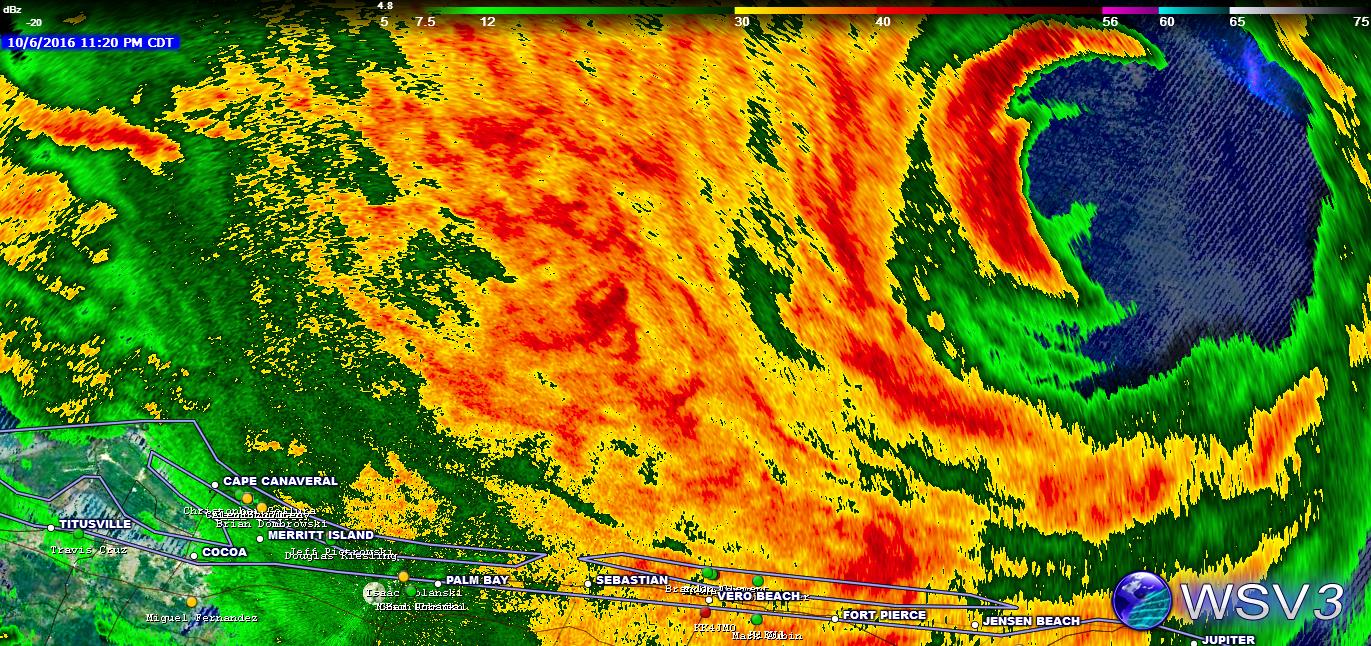
Second day on a week long break from my long hike across California brought us to Central Kansas. Where a juicy atmosphere was in place for an Outflow Boundary/Triple Point intersection. I awoke around 6am in Goodland, Kansas to take a look at models and see where we needed to be later that day. First thing I see when I pull up mesoanalysis is morning convection over Kansas. Not exactly something you want to see the morning of a chase day. Then, I was baffled to see that the Storm Prediction Center had removed the slight risk area and replaced it with a "Marginal Risk" with still a 2% tornado threat for the 13z update, noting the morning convection potentially ruining the day. Brennan woke up shortly after I took a look at models and asked me how it looked. I responded with "Looks like crap" and we both fell back asleep until about 11am.


We were already out here, and on our way back to Iowa. So there would be no sense in bailing on the chase day. Especially since it was on our way back. So, while on I-70 West visible satellite was showing a very obvious outflow boundary draped over Salina. Ample clearing was also underway at this point with 4500 cape and upper 60 degree dew points streaming North towards this boundary. The boundary was also located near a triple point off to the West, that would be the focus point for storm initiation later. One thing that was also noted on the drive West that afternoon was our 500mlb bulk shear appeared to be stronger than models the night before had been hinting at. Seeing all of these parameters in place really confused me as to why there still wasn't at least a "Slight Risk" issued for parts of Kansas. A notable concern was a strong cap in place. But, if it went fun times were to be ahead. By 1630z the slight risk area had returned but, still with 2% tornado probablities. Now, I'm not one to obsess over tornado probablities issued by the SPC. However, the atmosphere that I was seeing appeared to be volatile. Especially with an OFB boundary present that would enhance low level helicity. Something that was lacking this particular day.

Brennan and I arrived in Salina around 3pm, and knew there was no reason to be in a hurry. With the strong cap in the place, we knew it'd be a later show. We briefly parked at a McDonalds and looked at models again. Most composite models were not breaking out precip for our target area. However, they were breaking them out further down the dryline. Briefly discussing about potentially heading to McPherson to keep both options in play we looked at visible satellite, looked at each other and both shook our heads and committed North. There would likely be storms to the South as well. However, winds were not backed down there and veered to the Southwest. While up North we had Southeast winds, an outflow boundary, and a triple point with "only" 4500 cape. Sure, there was 6,000 cape to the South. But, that won't matter if you don't have backed winds and with no boundary to the South, the likelihood of winds backing was not likely.


My best friend, and chase partner Alec Scholten who was also out chasing with the tours he hosts (Twisted Sky Tours) was in the area with our other good friend Shanda Hinnet and Dillon Killoren. So, we met up with them to discuss the day. Also joining us for a briefing was our new friend and fellow PCT hiker (from 2015) Jason Caster. As we all patiently waited in the restaurant for initiation Jason's chase partner Eugen had taken a look at the HRRR and to all of our relief it was showing signs of life for the northern play. This model had a supercell blowing up right on the TP around 23-00z. So, on that note all of us packed up and headed a few miles West where some agitated CU were underway. We didn't make it but 10 miles West of Salina before the first tower went up and began showing up on radar.


Sadly, the closer we got to this storm it became apparent we still had a capping problem. The storm become "fluffy" and by the time we got to where the base would be. Nothing was left but an orphan anvil. It was also at this time a storm exploded East of Wichita where most of our friends were. I checked a group chat that I am in with them and all I saw from them was "big push! big push! Everyone get South now!". I briefly began sweating bullets as this was the area that had been upgraded to a 5% by the SPC. Sticking to our guns, we noticed another updraft going up on echo tops. Much, much faster than the first attempt. 20,000 feet, 40,000 feet, 50,000 feet. I remember saying to Brennan while sitting in the car watching this updraft go off like a bomb on radar "I wonder where this guy is." and hopped out of the car, turned North and saw an explosive tower sky rocketing into the air. We headed North out of Brookville on N Brookville Rd to Tescott and parked on a dirt road South of town and watched the storm rapidly mature.


I could see the towers going up on real time. It was as if my eyes were watching a timelapse film. Something I have never encountered while storm chasing. The craziest part about this storm is even as a young thunderstorm, it already had warm RFD. Brennan and I also ran into Alec and Shanda on this road where we all stood in awe at the updraft continuing to reach into the sky before getting hit with the RFD.


The storm was now severe warned and taking on "the shape" we all love to see. Especially this early in its life. I also noticed that the OFB had drifted slightly North of 70 throughout the day and this storm was rooting to the boundary as it began to turn very hard right. We continued East to pace it and that's when a small funnel began to develop! This storm wasn't even fully surface based yet and we already had a funnel and rapidly rotating wall cloud. My curiosity also got the best of me and I briefly took a look at the Southern storm on radar. While it was isolated it had a small core presentation on radar. Showing signs of it also battling the cap. Someone had also posted a photo and the updraft was very small and thin. The show had set itself and it was time to have a front row seat.


As we closed in on the developing funnel, we topped the hill pictured above when all of a sudden a dust swirl darted across the road below the funnel. Tornado!!!!! On low risk days like these a tornado is far more rewarding than high risk days. We quickly pulled over and watched the tornado begin to condense to the ground. The tornado was a majestic white color. This was due to our positioning West of it where the sun wasn't blocked. I briefly thought this was going to be a full on Mulvane, Kansas type tornado. The dirt it was hitting was also a red color so the dust swirl was a vibrant red. Perfect for photos.


Shortly after the tornado crossed the road in front of us Alec and Dillon pulled up and we all ran towards each other jumping for joy and celebrating with high fives!


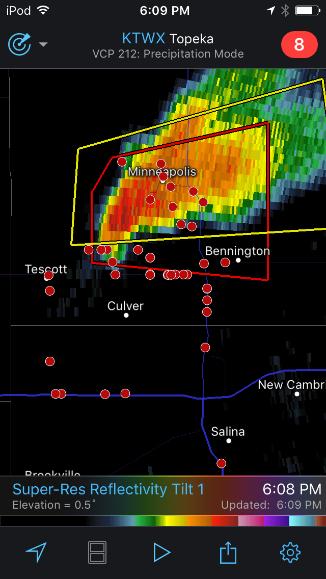
The tornado remained on the ground for about 2 minutes before it began roping out. The craziest part? This tornado occurred only 5 miles West of Bennington, Kansas where we watched a violent, and stationary EF4 tornado just three years ago around the same time frame as well. We thought this was it for the day and couldn't be happier with our second day of tornadoes. Boy, would we be proven wrong about 30 minutes later......

After the tornado roped out we began heading East again to keep up with the storm, which became elevated. Even more so than before. We arrived on North 90th road where we bumped into our other good friend, and fellow storm chaser Adam Lucio. Then, Jared Stevenson, Blaize Edwards, Nick Slone, and Lisa Monk all pulled up pretty surprised to see Brennan and I. As we were supposed to be on trail in this time frame. After a nice reunion we all parted our separate ways to continue the chase. Dillon, Brennan, and myself headed East on highway 18. Having flashbacks to May 28th, 2013. This was the same highway we filmed the Bennington, Kansas EF4 tornado. I mentioned to Brennan "wouldn't this be crazy if another tornado happened by this highway?".Which was funny, because later I found out that Adam Lucio had said the samething to the folks he was chasing with. This didn't appear likely though. While our storm looked fairly good on radar, and still tornado warned, it looked terrible in person. It was so high based I didn't think there was a glimmer of hope of that base coming back down. But, we were still optimistic. Because even with such a high base it managed to spit out another funnel. This was a sign of how much vorticity was in place.


As you can see pictured above. There was not much reason to be very optimistic about this storm last much longer.


The storm also wasn't really beefing up like we like to see. It still looked about the same as it did when it first went severe warned. As the storm moved East of highway 81 we hook sliced on highway 18 going through the town of....you guessed it! Bennington! On yet again, the same highway many people filmed the 2013 tornado on. We had to be careful doing this however, because we were in a rental. Which we had to return in one piece. Hail began to fall, but nothing that appeared likely to damage the vehicle with the exception of occasional golf balls that never hit the car. I messaged Alec on Facebook and his message said "We just had tennis balls. This day is awesome!". So, I yelled "DRIVE SOUTH DRIVE SOUTH" away from the core. We parked in the small town of Niles and watched the storm. Watching the radar loop, it was apparent this cell had rerooted to the boundary (as it had turned hard right again and was now drifting East/Southeast). The base had lowered substantially and rain bands began to dance. In the back of my mind I knew something big was about to happen. I just never said it, because part of me was still thinking this storm was toast, or would put down another tornado like we saw before. A bowl funnel began to dip down from the wall cloud that was spinning like a carousel. Come to think of it, I don't think I have ever seen a wall cloud spin as fast as this one was. It almost could make you dizzy. Dillon, Brennan, and myself began to reposition East until I looked back and saw a funnel halfway down to the ground I began yelling "its about to do it! its about to do it!" no sooner than those words left my mouth the tornado fully condensed to the ground. Tornado number 2! But, this one was far different than the other one. This had classic, supercell structure and the wall cloud above was rotating very violently and the tornado was display chaotic motion. Something you normally see in the beginning stages of a violent tornado.


It didn't take long for this tornado to quickly grow in strength and widen into a very large stovepipe as we continued to head East. Due to limited roads we wanted to have our options ready to go when it got closer. The good thing about this storm is it wasn't hardly moving (yet again). So we were able to keep up with it even with limited roads.


Brennan was busy driving I said "Holy sh.t! Violent tornado!" and when Brennan pulled over he had the same reaction. I couldn't believe it. Yet ANOTHER violent, slow moving/nearly stationary tornado on a marginal day near Bennington just three years later. Both of which thankfully spared the town. This tornado had now been on the ground for 10 minutes and showed absolutely no signs of lifting. If anything, as time went on, it became more and more violent. As we stood there and filmed I noted a loud, deep, thunderous noise. Which originally, was thought to have been a clap off thunder. Until it kept going, and going, and going. It was the tornadoes roar causing this noise. Never in my life have I ever heard a roar this loud before. It was as if I was standing in front of 10 Niagara Falls. I didn't think it was possible for a tornado to be much louder than the Stanton, Nebraska EF4 tornado back in 2014. But, boy was I sure proven wrong. This tornado made that one look like a brief spinup.


The longer we tracked this tornado, the more incredible it got. We had to drop South before heading East due to roads and in that time frame the tornado was now a quarter mile wide with an incredible RFD cut above and color cloud. This tornado was like Bennington met Coleridge. Even from this far away you could hear the tornado. Normally audible roars this loud is from a tornado tearing through a town. But, this one was this loud as it churned over open fields. I cringe to think what it would have sounded like if it hit a town.


Radar grab as the storm begins to rapidly intensify.


Velocities maxed out indicating a violent tornado is underway

This storm was also nnow 70,000 feet high! Something that doesn't happen very often. In fact, in my 6 years of chasing I have never seen it. The highest storm I have documented was 60,000 feet which was also in Kansas but on September 1st, 2014.

We rushed North out of Solomon off of highway 70 in hopes of getting an up close view of the tornado. Unfortunately we didn't beat it across the highway. But we did have a pretty incredible view of the tornado with structure from a bit closer.


It doesn't get anymore textbook than this for tornadic structure. The RFD cut was so clear the sun shine was coming through it. It was also this point the tornado started to become rain wrapped. A perfect opportunity for us to get East and hopefully get our intercept. Brennan, Dillon, and myself got back onto I-70 and quickly darted East ahead of it. It was almost as if the tornado knew we were coming for it. As soon as we turned North out of Abilene on Highway 15 it revealed itself from the rain. But, not as a wedge. As a violent drill bit! We pulled off as it hurled debris into the air and Brennan mentioned it crossing the road so we didn't stop long. We got back in the car and floored it North. We thought for sure the tornado was in its rope out stages so we wanted to get as close as possible as it was a little more predictable now that it wasn't a huge wedge.


Time to dance. The tornado heading due East, and us heading due North we got closer and closer to each other. We pulled off while the tornado was about a half mile away in the field next to us keeping a steady course.


This is where being situationaly aware and having an escape option is key. Note the tornado beginning to widen into more of a stovepipe. This normally indicates a tornado is reintensifying. There were also little vorticies that would shoot out ahead of the tornado. Something I also hadn't seen before.


Even with the tornado widening and little vorticies ahead of it, the tornado still appeared to be moving from left to right. Indicating it still moving slightly away from our position. So we held our ground. As the tornado got closer winds really started to ramp up. Our friend Dillon who was behind us had already turned around and retreated back a bit. I calmly told Brennan to flip the car around and be ready to go. Just in case the tornado decided to make a sudden turn towards us.


The tornado continues to grow and is now back to a large, fat stovepipe. At this same moment I see a large plume of debris at the tornadoes base. Houses have taken a direct hit. Not what a chaser wants to see. At this sametime that debris from homes, and trees are raining down on our car.


Still holding tight to our position as its now obvious the tornado will cross the road behind us, I do become a bit unsettled with how much debris is raining down on our car and how high winds were getting. As the tornado crosses the road we are in winds over 100mph. Meanwhile, Dillon is further back filming it all and trees behind us are being shredded, and multiple trees topple over.


This is a video grab from Dillon's chase partner (and now our new friend) Bill Kirkspatrick dash camera as it rolls during our close intercept. Circled is our car as it approaches the road.


Circled in white is the tree behind us being blown over and dragged. Circled in rain is where we still are as we vanish from their video. I will note I never felt in any danger. We had a great grasp on the situation and were ready to bail when needed.


This is the most dramatic image I have ever captured and the closest I have ever been to a tornado of this magnitude. Up until this, the Elmer, Oklahoma EF3 tornado was my closest and I was a half mile from that one. For Chapman, we got a meer 100 yards! After this image was taken, we bailed about a half mile South, as winds were becoming too intense for our safety. I also feared with the high winds and debris we'd lose a window. We pulled off by Dillon and Bill as they yell "YOU CRAZY BASTARDS!!!" and gave us a high five for a job well done. We alerted a police officer near 70 that homes had damaged and they quickly responded with medics. Thankfully, from what I heard nobody was injured. The tornado also narrowly missed the home in the image above. While they did sustain damage, its a miracle it the house wasn't whipped off the map.


Back on I-70 heading East the tornado grows back into a quarter mile-half mile wide tornado! I have never seen a tornado come to close to roping out just morph back into a gigantic wedge in just a couple minutes. Time to intercept again! Also I should note the tornado has now been on the ground for over an hour!


We are now a few miles South of Moonlight, Kansas watching the ominous wedge get closer and closer to the tree line we parked by. Vibes were slightly different for this approach. We couldn't see the base of the tornado, trees could act as big pieces of debris to damage the car, and the tornado was moving on a Southeast course now.


We came to a mutal decision to back up just a bit to give ourselves more room. The sun was also beginning to set, it began to cast an ominous orange glow on the tornado.


I snapped this dramatic, wide angle shot as the tornado passes behind a home that was right across the street from a gas station where many motorists were taking cover.


My heart stops as the tornado begins to cross the road we were just on. Because I noticed that an RV park was so close to the tornado. One shift and all of those are toast. Thankfully, the tornado passed about a mile or two North of the mobile home park not causing any serious damage.


large chunks of debris falling out of the sky, a roar equal to standing beside of a jumbo jet with its engines on, and a half mile wide tornado eating anything in its way. This is a scene straight out of a nightmare. This is also probably the most dramatic footage I have shot in my chasing career. Even more dramatic than the close intercept.


The tornado is now nearing its peak intensity (as if it could get any more violent) and horizontal vorticies extend out from the tornado. At this time, a rare tornado emergency has now been issued for Chapman, Kansas. This is the highest warning that can be issued and the NWS even stated "Catastrophic tornado on the ground" in the text as the tornado churned its way towards town.


The now, nearly mile wide tornado is approaching I-70. A major interstate that goes across Kansas. I know how people are when it comes to their logic and tornadoes. They just keep driving. My heart again sunk to the ground as I kept watching semis and cars drive towards the tornado. Thankfully, people were smart and pulled off to let the tornado cross. Brennan and I decided not to continue on 70 as we knew it'd be shut down for debris. Briefly dropping South and East we decided to call the chase as the tornado became more rain wrapped. No sooner than we did that, a debris ball showed up on reflective radar. Indicating debris being lofted so high it was being reflected off the radar. Brennan and I prepared ourselves for a mass casualty event as we thought Chapman took a direct hit. We started our way towards Chapman but, quickly heard from other chasers the town was spared. However, one house just West of town was not so lucky and was whipped off the face of the earth. Foundation included. The tornado was so powerful, it even bent the railroad tracks in front of the house, debarking trees, and tossing huge farm equipment including a bulldozer. All that was left of a full size semi cab was a twisted up frame in the shape of a pretzel and the family cars had been tossed over a half mile into the field. The cars were so mangled you couldn't even tell what type of car it was. You couldn't even tell if it was a car, truck, or what. But, later that evening we heard there were no deaths or injuries. Even from the house that sustained a hit. Unbelievable. We met back up with everyone in Salina that night and celebrated with giant steaks at Applebees.

Conclusion:

Chapman, Kansas is the luckiest town on the face of the earth. Had the tornado not turned Southeast at the last moment, I have no doubt there would have been many deaths, and the town I doubt would have ever come back. Another crazy thing to note, is had this tornado of happened 10 more miles South it would have leveled Solomon, Abilene, and Chapman. Out of its 90 minute, 26 mile track it only hit a couple homes with no injury or death. Absolutely unbelievable. This tornado was given an EF4. However, it could be debated that it was much stronger. Unfortunately, cars and railroad tracks can't determine a tornadoes rating in a survey. But, that's how it goes. This was by far the most violent tornado I have ever seen, and I never thought I'd see the day where I saw something more incredible than the Pilger, Nebraska twin EF4 tornadoes on June 16th, 2014. But given how we absolutely nailed the forecast, got multiple close range intercepts, and how violent this tornado was with the incredible structure above. It will go down as my number 1 chase thus far. Especially for it being on a 2% tornado day. Yes, this tornado happened OUTSIDE the 5% risk area.


Final Reports


Footage from the day
Chapman, Kansas Tornado Footage